نبذة عنا
تأسست مؤسسة سعودي رجاء للهندسة الجيومكانية والنظم الجغرافية والاستشعار عن بعد عام2015 م بمدينة الرياض . هو مكتب هندسي يقدم لعملائه جميع حلول المشاريع والمشاكل المعروضة مع التقيد بوقت المشروع. ويمتلك المكتب الإمكانات التي تسمح له بإعداد مشروعاته وتنفيذها على أعلى مستويات الدقة والجودة والكفاءة ، من بداية مراحل تصميم المشروع الى نهاية مراحل تنفيذه طبقا للمعايير التصميمية القياسية المتبعة
المزيد
نبذة عنا
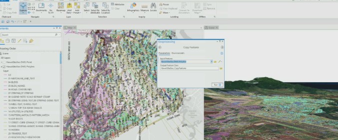
تقدم مؤسسة سعودي رجاء حلولًا متقدمة في مجال الهندسة الجيومكانية تشمل تصميم وإدارة قواعد البيانات المكانية المتكاملة، وإعداد الخرائط الطبوغرافية والكادسترال بدقة عالية، بالإضافة إلى تطوير حلول هندسية تعتمد على الموقع لدعم مشروعات البنية التحتية، التخطيط العمراني، وشبكات الخدمات.
المزيد
نبذة عنا
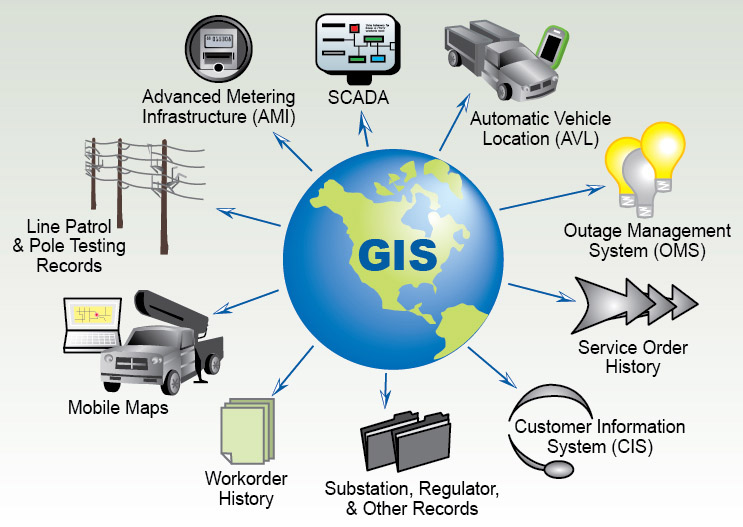
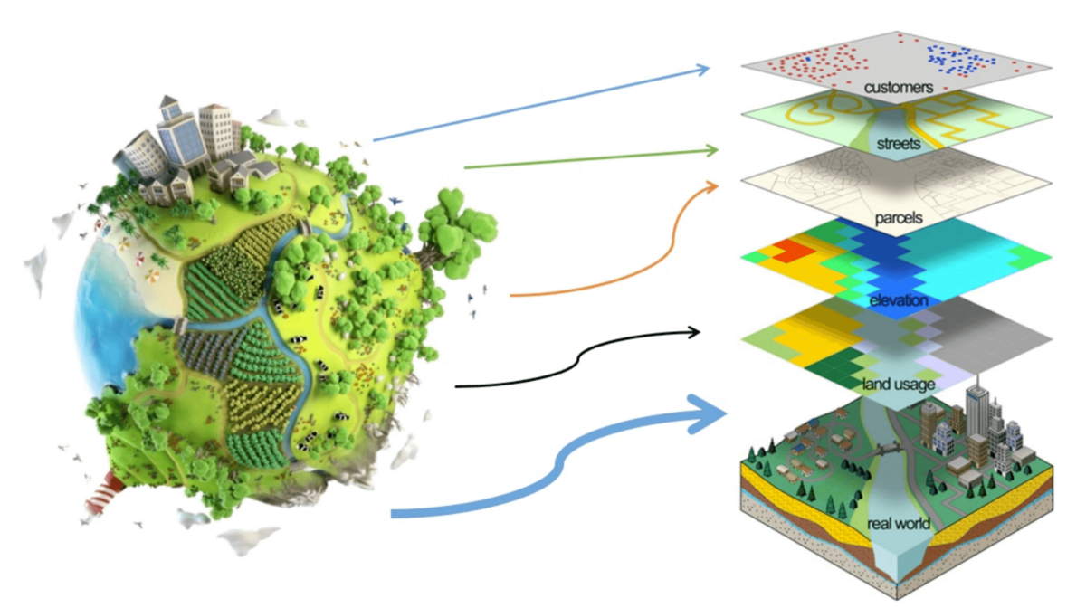
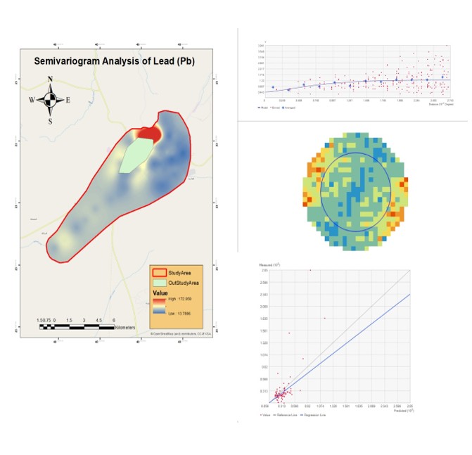
تختص مؤسسة سعودي رجاء بإنشاء وتطوير نظم معلومات جغرافية متكاملة تلبي احتياجات الجهات الحكومية والشركات، مع تقديم خدمات تحليل البيانات المكانية، وإنتاج خرائط تفاعلية ولوحات معلومات متقدمة لدعم اتخاذ القرار، بالإضافة إلى ربط الأنظمة الجغرافية ببرامج وخدمات أخرى لتحقيق إدارة فعالة للأصول والموارد.
المزيد
نبذة عنا
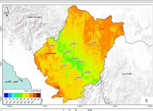
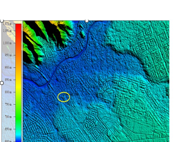
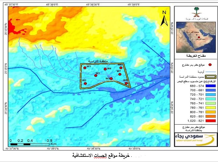
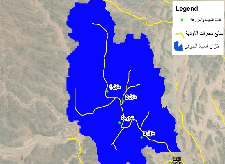
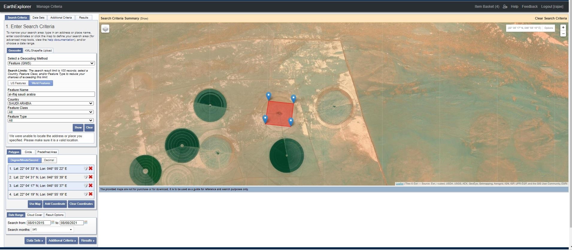
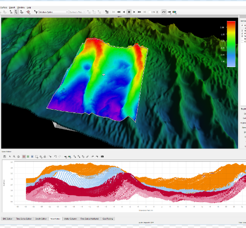
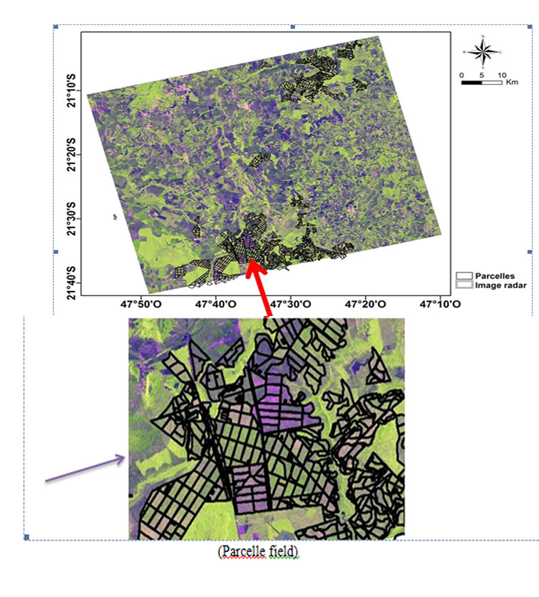
توفر مؤسسة سعودي رجاء خدمات معالجة وتحليل صور الأقمار الصناعية والطائرات بدون طيار بدقة عالية، وتستخدم تقنيات متقدمة لرصد التغيرات البيئية والزراعية، ودراسة استخدامات الأراضي، ومتابعة تنفيذ المشاريع الكبرى، بالإضافة إلى إنتاج خرائط دقيقة باستخدام بيانات LiDAR وSAR.
المزيد
نبذة عنا
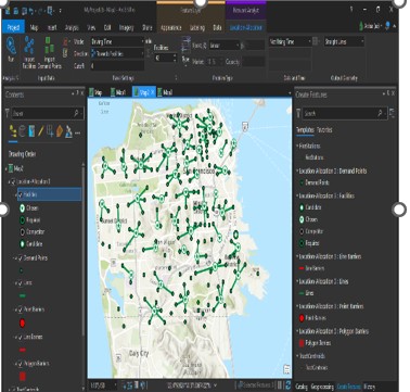
توفر مؤسسة سعودي رجاء حلولًا تقنية متطورة تشمل برمجة وتطوير تطبيقات خرائط مخصصة، وأنظمة GIS قائمة على الويب، بالإضافة إلى تنظيم ورش عمل ودورات تدريبية متخصصة في نظم المعلومات الجغرافية والاستشعار عن بعد، لرفع كفاءة الكوادر في مختلف القطاعات.
المزيديمكنك الأطلاع على المزيد من خدماتنا بالضغط على زر المزيد .
المزيد


احدث المشاريع

عن المؤسسة
تأسست مؤسسة سعودي رجاء للهندسة الجيومكانية ونظم المعلومات الجغرافية والاستشعار عن بُعد بمدينة الرياض، ومرخّصة من الهيئة العامة للمساحة والمعلومات الجيومكانية . تقدم المؤسسة مجموعة متكاملة من الدراسات والحلول للمشاريع الجيومكانية، مع التزام بالجودة والدقة والجدول الزمني للمشاريع. تمتلك المؤسسة فريقاً متخصصاً وإمكانات تقنية متقدمة تتيح لها تنفيذ المشاريع من مرحلة التصميم الأولى حتى التسليم النهائي، وفق أعلى المعايير والمواصفات العالمية.
هدفنا الاساسي هو عرض خبراتنا و القيام بالدراسات في مجالات تخصصاتنا وفق المواصفات والمعايير المعتمدة, التي تلبي احتياج العميل في نظم المعلومات الجغرافية (GIS).
القيام بتوفير الخدمات و تحقيق النتائج بدقة وكفائه عالية و باقل تكلفة في الوقت المطلوب, ونطمح ان يكون مكتبنا من المكاتب الناجحة داخل المملكة وخارجها.
شركاء